
Bernalillo County Previous Residents Sources
Address history in Bernalillo County has distinct local eras. Recorded instruments provide an ownership trail. Directories and phone books add a dated household or address context. Permit systems date projects and applications. Maps show the building and street setting but do not name occupants. Use the source whose date and purpose match the question, then preserve the document number, publication date, or map sheet that supports the connection.
| Source | Years it covers | Where held | What it can show |
|---|---|---|---|
| Clerk Kiosk certification statement | Jan. 1, 1800 to July 6, 2026 | Bernalillo County Clerk Kiosk | Recorded-document search and copy route; completeness by image or record type was not independently verified |
| Albuquerque City Directories | 1908 to present, reported institutional holding | Albuquerque Public Library Main and UNM Center for Southwest Research | Dated name and address context |
| Special Collections property sources | Assessor rolls 1884 to 1912; abstract-title collection 1880 to 1950; permits by street 1913 to 1937 | Local house-history resources | Property and building context; the abstract collection is incomplete |
| City permit reports | Pre-June 2008, June 2008 to Sept. 25, 2016, and Sept. 26, 2016 to present | City Building Safety and Planning Records | Project, application, and permit timing |
| Sanborn maps | Albuquerque volumes intermittently 1891 to 1957 | Library of Congress, library databases, and microfilm sources | Building, street, block, and address continuity |
The County Kiosk's stated certification range should not be read as a promise that every historical image or spelling is online. If a Kiosk search stops, use the Clerk counter or copy route, Planning Records, Special Collections, or a focused request for an existing document. A useful request identifies the parcel, document or permit number, date range, and jurisdiction.
Bernalillo County Past Residents Deeds
Start the backward trail with a fixed seed address. The Assessor or Treasurer can supply property-account context, while County PDS mapping serves unincorporated parcels and the City Advanced Map Viewer serves municipal address work. Record the parcel, PIN or UPC, lot, block, subdivision, and legal description before searching names. A legal description holds a property identity more reliably than a street name that may have changed or been formatted differently over time.
- Write the complete address, including designation, quadrant, unit, city, and ZIP. Resolve the property in the appropriate City or County map system.
- Save the parcel or PIN or UPC and the lot, block, subdivision, or survey description. Compare map fields with the Assessor or Treasurer result.
- Search those terms in the Bernalillo County Clerk Records Public Access Kiosk. Retain the document number, recording date, grantor, grantee, and legal-description match.
- For a purchase instrument, search the prior seller as a grantee to locate that person's earlier acquisition, while checking that the legal description still matches.
- Repeat by date. If a lot description changes after a plat or subdivision, document that change instead of assuming a break in the chain.
- Grantor
- The party conveying or releasing an interest in a recorded document.
- Grantee
- The party receiving an interest. A past grantor can become a prior grantee when the chain is followed backward.
- Chain of title
- The sequence of recorded transfers or interests attached to the same legal property description.
- Legal description
- The lot, block, subdivision, or survey language that identifies land in the recorded system. It is not the same as a mailing address.
The Kiosk supports name, grantor, grantee, date, document number, book/page, parcel number, subdivision, lot, block, tract, unit, and survey fields. Its operators can help with historic spelling variation, but a similar name is not enough to join two people or two properties.
Bernalillo County House History
After the deed chain is anchored, local history sources can fill an address interval without converting ownership into a full household list. Albuquerque Bernalillo County Library Special Collections has city directories, phone books, historic maps, neighborhood material, census resources, obituaries, family histories, church archives, and yearbooks. Its Genealogy Center is a practical human-access channel when a volume or local reference file cannot be reached through a public search screen.
The Albuquerque library's additions and subdivisions house-history guide joins public documents, zone atlases, Sanborn maps, newspapers, and research databases around an address or subdivision.
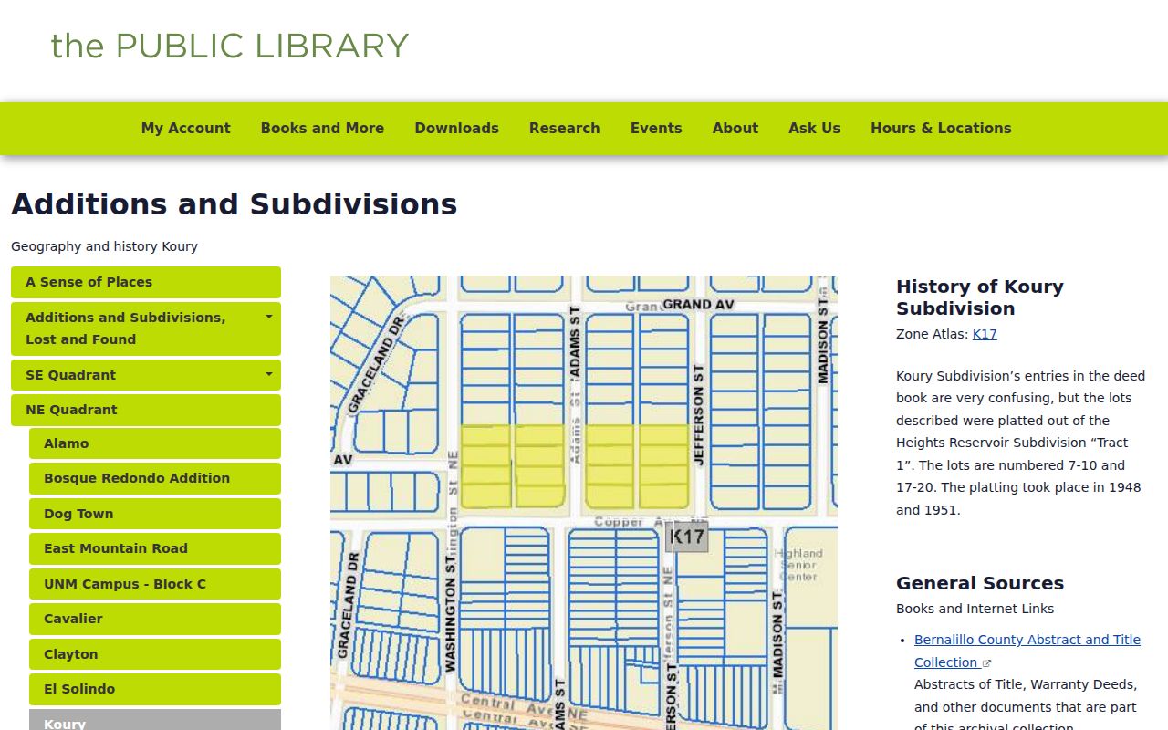
The guide is useful after the address has been normalized. An addition name, plat, or map sheet may resolve a mismatch that a modern street name alone cannot.
One local historical resource has especially concrete pre-digital material: assessor rolls for 1884 through 1912, an incomplete Abstract & Title Collection for 1880 through 1950, and Building Permits by Street Name for 1913 through 1937. Treat each as a dated observation. Missing coverage does not establish that no earlier resident or building existed.
Bernalillo County Previous Residents Permits
Permits can date work at an old address and sometimes preserve project or listed-contact context. They do not establish every person who lived at a property. For Albuquerque addresses, the City divides permit access by era: the current Building Safety tool begins September 26, 2016; KIVA report material covers June 2008 through September 25, 2016; older data use the pre-June 2008 report collection or Planning Records. County Accela is the route for unincorporated addresses.
The City Building Safety permit-search page documents those date segments and directs older record questions to Planning Records.
Use the permit era before drawing a conclusion from a no-result. A City address and an unincorporated county address can require different systems, even when both are in Bernalillo County.
Bernalillo County Previous Addresses
Old address wording can be the real barrier to finding past residents. Albuquerque's grid uses Central Avenue as the north-south divider and the Santa Fe Railway tracks as the east-west divider. A missing quadrant can identify another street or yield no result. The City historical study also records roughly 650 street renamings with four-quadrant adoption on July 1, 1952, and notes that Railroad Avenue became Central Avenue in 1912.
Search both the older and modern form, then join the results with the legal description, addition or subdivision, parcel, or map sheet. Do not merge two address records just because their street names look related. The documented Albuquerque study supports the name-change history used for this comparison.
Bernalillo County Past Residents Directories
Ownership is only one layer of an address history. A dated city or reverse directory can place a name, residence, boarding place, address, or telephone context at a location for the year of publication. The historic collections themselves belong in the Bernalillo County City Directory research path; here, use them as a checkpoint between two recorded deed dates.
- Choose the directory volume closest to the target year and copy the entry exactly, including any addition, corner, occupation, firm, or residence wording.
- Check the prior and next available volumes for the same address and surname. Preserve two-surname and spelling variants where the source uses them.
- Place each directory date alongside the deed interval, permit date, and map evidence. Do not use one entry to fill an unobserved span.
- Pair the nearest released federal census with that directory year. The newest public individual federal census is 1950, and the State Records Center and Archives holds historic census microfilm.
- Keep household evidence separate from title evidence. A directory may show an address context even where ownership is recorded in another name.
Note: A census date and a directory date are separate observations, not proof that the same household remained at an address between them.
Bernalillo County Previous Residents Maps
Sanborn maps are an address-continuity tool, not an occupant source. The Library of Congress provides a digitized Albuquerque volume published for 1942 through April 1957 and republished in 1957, with 81 sheets. Local Digital Sanborn access can help identify building outlines, size, shape, materials, height, function, streets, sidewalks, boundaries, and house or block numbers.
Use the Library of Congress Albuquerque Sanborn volume to test whether a structure, street label, or block appears in the mapped period. Then pair that map date with a deed, directory, permit, or newspaper result. The map cannot name prior occupants, so it should never stand alone as evidence of a household.
Bernalillo County Previous Residents Limits
Past residents research has firm privacy boundaries. A deed identifies parties to a recorded instrument, not a complete residential chronology. An Assessor card can distinguish situs and owner mailing fields, and neither field proves who was present at the property. Personal voter lookup is not a public address browser. Driver-license data, utility-customer data, and protected addresses are not substitutes for the records described here.
New Mexico Safe at Home is an address-confidentiality program for eligible survivors. Participant records are confidential and are not subject to IPRA; their residential or delivery address, telephone number, and email held by agencies are public only by court order. Confidential voter addresses do not appear on public voter lists.
Lawful house-history use. Use an address trail for family history, property history, estate research, or civic context. Do not use records to follow, threaten, harass, or frighten a living person.
Bernalillo County Trail Endpoints
When the address trail reaches a historical household, corroborate the date and identity through a source that fits the event. Special Collections and the Genealogy Center hold obituaries, family histories, church material, yearbooks, maps, and census resources. Probate is a separate court record path; the Bernalillo County Probate Court handles informal probate and estate cases. Newspapers, cemetery material, and archival collections can extend a search only where the name, address, and date agree.
The New Mexico State Records Center and Archives primary-sources program is a fallback for historical census microfilm and archival clerk, assessor, and probate materials. It is better to preserve a gap than to turn a matching surname into an unsupported story about prior residents.