
Search Bernalillo County Streets
Use the street directory as an address workflow. The County Treasurer gives the clearest documented starting point for a named street: enter the street without its suffix. A search for main, for example, can return the addresses on Main, while a number narrows the result. That identifies a property or tax account, not everyone connected with a home. From there, match the number, street designation, quadrant, unit, tax year, and parcel identifier before moving to recorded documents.
Jurisdiction comes next. County PDS mapping and Accela serve unincorporated Bernalillo County, while the City of Albuquerque has its own map and permit routes. A street directory search becomes more reliable when the parcel or legal description follows the address through each system. Historic directories can add a dated address entry, but they should remain dated evidence rather than proof of a current household.
- Run the street name or exact address in the Bernalillo County Treasurer property search, then record the parcel and tax-year context returned.
- Compare the address in the Assessor record and identify whether the parcel lies in the City or an unincorporated county area.
- Use the applicable map to capture the PIN or UPC, lot, block, subdivision, street quadrant, and address components that tie the records together.
- Search the matching parcel number or legal description in the Bernalillo County Clerk Records Public Access Kiosk for recorded-document parties and dates.
- Add a dated directory or permit record only after the address, parcel, and time period line up. That separates a historic address clue from an ownership record.
Note: A street-only property result is a practical way to move through addresses, but it is not a list of all people living along that street.
Bernalillo County Street Records
Different Bernalillo County records answer different address questions. The tax and property systems provide assessment context. Maps establish parcel geography and jurisdiction. The Clerk Kiosk connects a parcel or legal description to recorded instruments. Permit systems can add a dated project history. None of those systems is an all-household directory, so the type of record matters as much as the street name.
| Address-keyed source | Local keeper | Street evidence | Access route |
|---|---|---|---|
| Tax and property account | County Assessor and Treasurer | Address, parcel, tax year, owner-record context | Public address, parcel, and owner-record search |
| Parcel map | County PDS GIS or City AGIS | Parcel boundary, PIN or UPC, lot, block, subdivision, quadrant | Map query for the applicable jurisdiction |
| Recorded instrument | Bernalillo County Clerk | Grantor, grantee, recording date, document number, legal description | Kiosk, copy order, or Clerk counter |
| Permit and planning history | County Accela or City systems | Address-linked project, inspection, planning, or code context | Use the system serving that address and era |
| Historic directory or map | Library Special Collections and archives | Dated name, address, building, or street context | Collection, archive, or map access |
| Voter data | New Mexico Secretary of State | Controlled voter-data product, where lawfully requested | Written authorization process, not public street browsing |
The chain is deliberate: an address leads to a parcel, the parcel and legal description lead to a recorded instrument, and dates determine whether a permit or historic listing belongs in the same story. The personal New Mexico Voter Services screen requires identity-linked information and is not a street directory. Broader SERVIS voter data is subject to a written request, authorization, fees, and statutory use limits.
Bernalillo County Assessor Fields
The Bernalillo County Assessor Property Records interface supports address, parcel, and owner-record research. Its public disclaimer says the data may be preliminary or incomplete, are not updated in real time, and should be independently verified. The street directory use is simple: find a precise property account, then compare its parcel address and tax year with the map and recorded-document trail.
| Assessor field | How it helps an address search |
|---|---|
| Address number | Limits a street result to a specific street number; the observed maximum length is eight characters. |
| Street | Searches the street component; the observed maximum length is 20 characters. |
| Parcel ID | Uses the account identifier, with an observed maximum length of 22 characters. |
| Tax year | Lets the result be compared across Any or the observed 2017 through 2026 choices. |
| Sort by | Offers Parcel ID, Owner Name, Parcel Address, Roll Type, and Tax Year for organizing results. |
| Page size | Offers 10, 15, 20, 25, or 50 results per page when more than one property is returned. |
A returned property card can distinguish a current owner and mailing address from the situs or physical property location. It may also include class, tax district, property description, document number, building size, year built, acreage, land-use code, and style. Those fields are property context. They do not establish that an owner or mailing contact lives at the situs address.
Bernalillo County Street Maps
Map choice depends on the address. The County PDS Public Advanced Viewer covers unincorporated, platted parcels and is updated twice monthly. Its documented data fields include lot, block, subdivision, street number, street name, street designation, street quadrant, apartment, PIN, address, acreage, and jurisdiction. County mapping is a reference tool, not the legal-description source. For a municipal address, the City Advanced Map Viewer and Address Report provide a separate route for parcel, ownership, boundary, and public-service context.
Use a New Mexico ArcGIS Bernalillo County parcel-layer record to see the official statewide parcel-service context. The layer supports geographic query work, but a current Clerk record remains the source for a legal description or recorded dimensions.
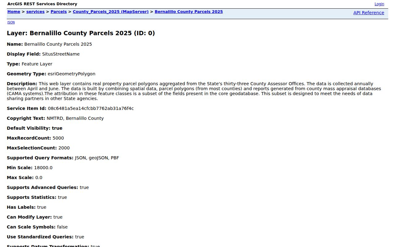
The parcel layer helps keep a street directory search anchored to parcel geometry. Pair it with the County or City viewer that has jurisdictional context, then check the Clerk Kiosk when a recorded title question is involved.
- Parcel
- A mapped property unit used by assessment and mapping systems. It is a bridge to other records, not a statement about every person at the site.
- Situs address
- The physical property location. A situs field can differ from an owner mailing address.
- Plat
- A recorded map that lays out lots, blocks, streets, or subdivisions. It can explain why an older and newer legal description differ.
- Criss-cross directory
- A reverse address listing that can place a name or telephone context at an address for a specific publication year.
Bernalillo County Street Permits
For an unincorporated address, the County Accela Building Search adds a second address-keyed record family. Its public choices include General Search, Search by Address, Search by Licensed Professional Information, Search by Record Information, and Search by Contact. Street name, city, ZIP, date range, record number, and record type can narrow a building search. The portal tip says removing the start date searches the full database.
Accela is jurisdiction-specific. A no-result at an Albuquerque city address may simply mean the City record system is the correct route. The City Building Safety page separates current results after September 25, 2016, KIVA reports from June 2008 through September 25, 2016, and older reports before June 2008. A permit supplies project or listed-contact context, not a complete account of people at the address.
The County Accela search screen shows the address, date, city, ZIP, and record-type routes available for unincorporated Bernalillo County work.
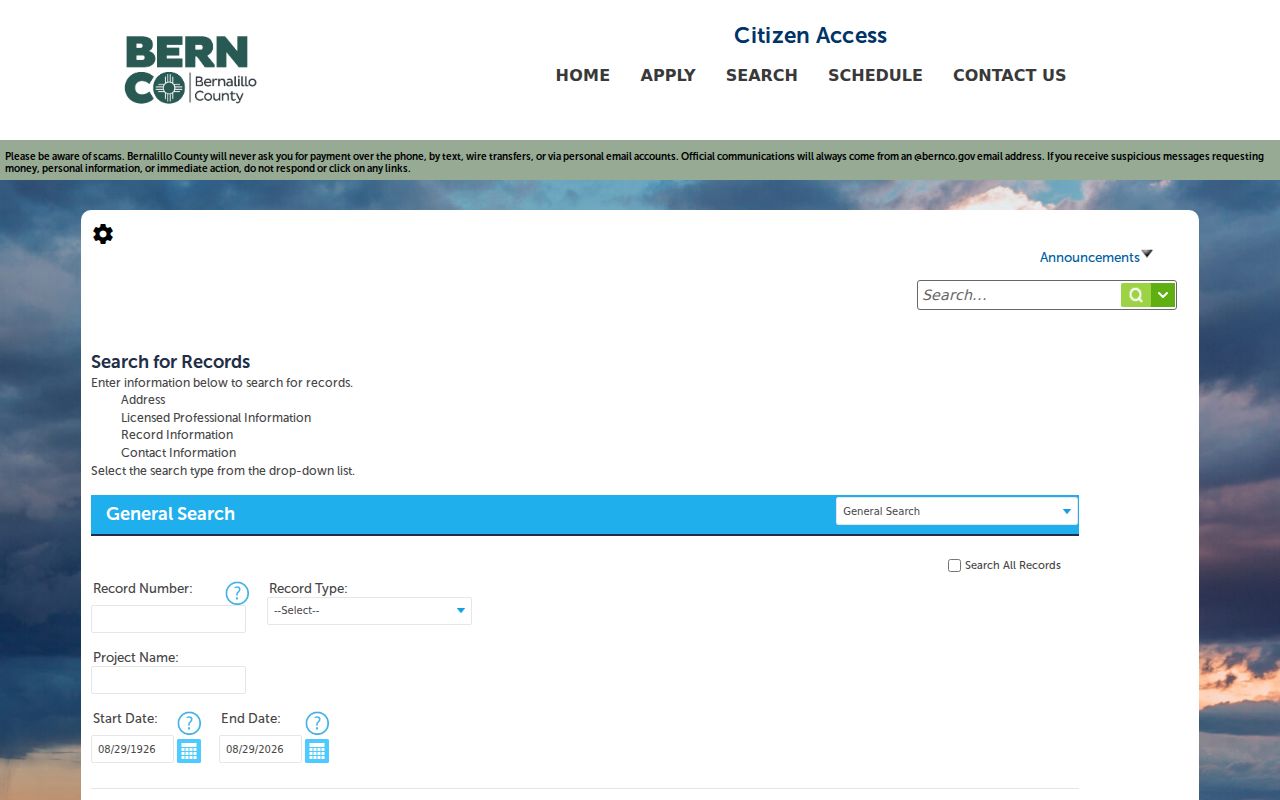
Use the screenshot's field choices to filter a known address after the map confirms county jurisdiction. For City addresses, use the City permit and planning channels instead of treating a County search as comprehensive.
Bernalillo County Street Deeds
A street directory can carry an address into the recorded-document side of the trail, but street text alone is weaker than the parcel and legal-description match. The Clerk Kiosk supports parcel number, subdivision, lot, block, tract, unit, quarter, section, township, range, legal remarks, and document-type filters. It also supports name, grantor, grantee, recording-date, document-number, and book/page searching. The Kiosk says recorder documents are certified from January 1, 1800 through July 6, 2026, while not promising that every image or historical index entry is complete.
For a long street, first take the property account from the Treasurer or Assessor search. Then search the parcel or legal description in the Kiosk, retain the document number and recording date, and compare the legal description on each instrument. A grantor is the party conveying or releasing an interest. A grantee is the party receiving it. That recorded relationship is more precise than an owner name copied from a map field.
Copies and certified-copy requests are integrated with the Clerk Kiosk. For older availability, a copy question, or a record that cannot be reached online, contact the Clerk or make a targeted request that names the parcel, document, date range, and jurisdiction.
Bernalillo County Quadrant Streets
Albuquerque's street grid creates a common address-match problem within Bernalillo County. Central Avenue divides north and south, and the Santa Fe Railway tracks divide east and west. North and west sides use odd numbering; south and east sides use even numbering. A missing NE, NW, SE, or SW quadrant can send a street directory search to a different result or no result at all.
A City historical study records another continuity issue: about 650 streets were renamed when four quadrants were adopted on July 1, 1952. Railroad Avenue had already become Central Avenue in 1912. For older address research, search both the historical and modern street wording, then compare an addition, subdivision, legal description, or Sanborn sheet before joining two records. The documented Albuquerque historical study is the source for those local naming changes.
Note: A quadrant, suffix, or older street name can explain a failed search without showing that the address, parcel, or person did not exist.
Bernalillo County Historic Streets
Historic address work changes from a current street directory to a dated-source exercise. Albuquerque City Directories are reported as an institutional holding from 1908 forward at the Albuquerque Public Library Main and the UNM Center for Southwest Research. Special Collections also maintains city directories, phone books, neighborhood studies, historic maps, census material, obituaries, yearbooks, and related local-history sources. Those collections can supply a name or address context for a particular date rather than a present-day result.
Other address anchors are unusually useful here. The local house-history material identifies assessor rolls from 1884 through 1912, an incomplete Bernalillo County Abstract & Title Collection from 1880 through 1950, and Building Permits by Street Name from 1913 through 1937. The Bernalillo County City Directory has the collection-focused approach for reading those volumes. Keep each listing tied to its printed year and do not fill a gap with an assumption.
Special Collections' additions and subdivisions research guide also connects public documents, zone atlases, Sanborn maps, newspapers, and library databases. These sources can clarify an old street name, addition, or building context after the parcel trail has been established.
Bernalillo County Street Limits
Address records have real privacy limits. Assessor, Treasurer, and Clerk systems track property, tax, and recording matters. They do not register every adult or household member at an address. Driver-license address information is restricted, and the research did not identify public utility-customer or delivery lists. An owner mailing address can differ from the site address, so it should not be treated as a statement about who is present at the property.
New Mexico's personal voter-registration lookup is identity-linked, and fuller voter data is a controlled written-request product with an authorization affidavit and limited purposes. Safe at Home participants have confidential addresses that do not appear on public voter lists. A public-records search must not be used to locate an address protected by that program.
Lawful personal use. Bernalillo County street records can support property, family-history, and civic research. Do not use them to follow, threaten, harass, or frighten anyone; New Mexico law addresses harassment and stalking.
Bernalillo County Street Gaps
When an address produces no result, test the record chain before drawing a conclusion. Confirm the quadrant, street designation, number, unit, and whether the address is municipal or unincorporated. Check the parcel and legal description rather than relying only on a typed street name. Historical scans can be missing, and the Assessor warns that its data can lag behind recorded changes.
For an existing record that is not online, the documented alternatives are the Clerk counter or copy order, Assessor and PDS contacts, Planning Records, Library Special Collections, and a specific request under the New Mexico Inspection of Public Records Act. A written request should identify the existing parcel, document, case or permit number, date range, and custodian with reasonable particularity. It does not require an agency to assemble a new street directory.